Everything for your home, in one tap
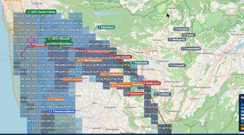
The map splits the flood into small 250 m squares. Search your place or tap your area — the map zooms in and gives you a clear answer for your square.
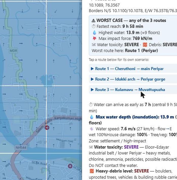
💧 Depth, arrival time, speed
Tap your square to see the highest water (in floors), the earliest time it could arrive after a breach, how fast it flows and its force — fast water is dangerous long before it is deep.
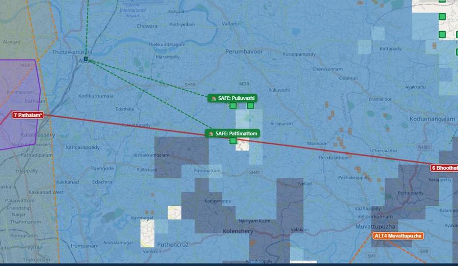
🏡 Your nearest safe high ground
Every square points to three safe places on genuine high ground, checked for landslide slopes. Tap Show and the map draws the way there with arrows, plus walking directions.
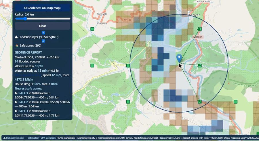
📍 Area report for your ward or village
Switch on Area report and tap a spot — one summary for everything inside the circle: first arrival, deepest water and the nearest refuges. Useful for schools, churches, temples, mosques and village groups.
Mullaperiyar — and Maniyar for Pathanamthitta
The map is built around a worst-case Mullaperiyar dam-break. For people in Ranni, Thiruvalla, Chengannur and Pathanamthitta, a smaller Maniyar Dam layer is also included — switch to it, or show both.
💧 Mullaperiyar Dam
- Flooded squares modelled60,330
- Flood routes compared3 (Periyar, Idukki gorge, Muvattupuzha)
- Reaches Bhoothathankettu~110 min
- Sea "hit-back" at the coastmarked
🏞 Maniyar Dam
- Perunad~20 min
- Ranni~1 h
- Kozhencherry~2.5 h
- Chengannur~4 h
Made for families, villages and planners
Search any place
Type your village or town in English or Malayalam — or use your phone’s location.
Three flood routes
Cheruthoni (Periyar), the Idukki gorge and Kulamavu→Muvattupuzha — see which is worst where you live.
Coastal double impact
Coastal squares are marked for the sea “hit-back” as the flood reaches the Arabian Sea and rebounds.
Landslide-prone slopes
Steep ground beside violent flow is flagged, so no one picks it as a refuge.
Debris & contamination
Industrial zones, heavy debris and unsafe water are shown square by square.
Works on any phone
Built for mobile, with a guided tour, Malayalam & English, and free alerts.
Four things to do today
Find your home on the map — search your place or use your location.
Tap your square — note the arrival time and the depth.
Check your safe place — tap Show and see the way there.
Share the plan with your family and register for free alerts.
In fast-moving flood water, move out of the flow path to higher ground before the water arrives — do not wait, and do not try to cross moving water.
Help keep Kerala prepared
How it was built
Built for public awareness and to give authorities a starting reference. The Mullaperiyar scenario follows a breach through the Idukki reservoir system and down the Periyar to Kochi and the sea, with the Muvattupuzha route included. The Maniyar scenario follows a full-pond breach on top of a peak-monsoon Pamba flood, down to Thottappally. Terrain is corrected against surveyed heights and local flood marks.
reubenckearth@gmail.com
Corrections, local elevation knowledge, data offers (KSDMA/CWC/LiDAR) and media queries are welcome.